


About the project
 WISEDRAVALIFE project is the result of a fruitful collaboration of participant organisations lasting for several years. In the frame of the project, partner organisations, namely the main applicant WWF Hungary and its partnership, the South-Transdanubian Water Management Directorate, Hrvatske Vode (Croatian Waters), the Danube-Drava National Park Directorate and SEFAG Zrt., clarify and elaborate the aims determined during the previous collaboration, make proposal for specific field interventions and initiate the implementation of these interventions."
Project name:
"Wise Water Management for the Conservation of Riverine and Floodplain Habitats along the Drava River"
project code: LIFE17NAT/HU/000577
abbreviation: WISEDRAVALIFE
Project Partners
Coordinating beneficiary: WWF Hungary
Associated Beneficiaries
- Danube-Drava National Park Directorate
- South-Transdanubian Water Management Directorate
- Hrvatske Vode (Croatian Waters),
- SEFAG Forest Management and Wood Industry Share Co.
Affected Nature 2000 sites
- West-Drava (HUDD20054), West-Drava-plain (HUDD20062) Middle-Drava (HUDD20056);
- HR1000014, HR1000015, HR1000016; HR5000014; HR5000015; HR2001308
Three target sites within the target area: Dráva main riverbed, isolated Dráva side-branches, Lankóc-forest [Lankóci-erdő]
Affected habitats
- 91E0 - Alluvial forests with Alnus glutinosa and Fraxinus excelsior
- 3260 - Water courses of plain to montane levels with the Ranunculion fluitantis and Callitricho-Batrachion vegetation
- 6440 - Alluvial meadows of river valleys of the Cnidion dubii
The estimated size of the project area
- improving water supply on 513 hectares
- transformation of river regulating structures on 3-5 locations
- 2-3 km long improved side branch conditions (1 side branch to be reconnected to the main branch)
Project duration: 2018.07.01-2023.06.30
Project budget
- Total project budget: 1,785,392€
- Total eligible project budget: 1,778,117€
- EU financial contribution: 1,057,071€ (=59.45%)
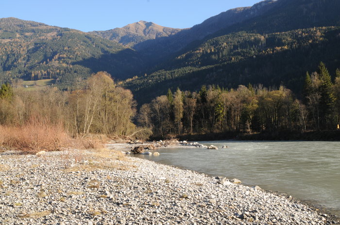
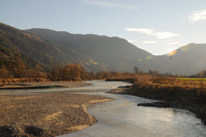 Good ecological and morphological status of Drava is the most outstanding amongst the Hungarian rivers. The conditions of the floodplain softwood forests and wetland forests (91E0) along the river are deteriorating, as the levels of both the riverbed and the groundwater are sinking. Hence, the water supply of adjacent habitats are inadequate, where signs of aridification can be recognized. Human activity has had various impacts both on the rivers‘ wildlife and people’s life so far. The interdependence of the experienced negative trends requires a complex impact analysis and solution planning.
The field interventions, which will be carried out during the project, aim to mitigate riverbed incision through which we intent to improve the floodplain forests‘ water supply as well. The project contributes to the improvement of HUDD20054, HUDD20062, HUDD20056, HR1000014, HR1000015, HR1000016; HR5000014; HR5000015; HR2001308 Natura 2000 sites‘ conditions. We plan interventions in order to achieve a more extensive impact in Drava‘s riverbed, on the floodplain area and in some sites of the West-Drava-plain, which are not directly effected by the river.
By conducting the necessary surveys during the project’s preparatory action, we will be able to outline the areas, where the field intervention is needed. We have already chosen a range of potential implentation sites during project planning, from which we will be able to choose during Action A1. Throughout the planning process, we would like to build on previous LIFE projects‘ experiences as well. In parallel, we will agree on the planning criteria taking into account the aspects of conservation, water management and forestry issues as well followed by technical planning and the licencing process.
The scope of the preparatory actions are way beyond the selection of the field interventions. The outcome of geodesic data gathering, digital sediment survey, land use analysis and the subsequent hydraulic modelling are two detailed studies: one of the causes and drivers of the riverbed incision and another one on the possible measures to mitigate the riverbed incision and the effects of it. In case of Lankóc-forest an inundation plan will be prepared based on the digital terrain modell of the area. Based on the inundation plan, a complete water retention plan will be prepared. The first steps of field interventions will take place in the WISEDRAVALIFE project.
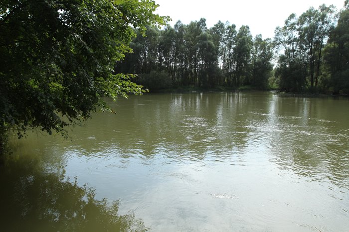
 The proposed work in the Drava main riverbed will be carried out at locations, where the existing regulating structures can no longer carry out their original function due to the quickly changing morphological conditions of the Drava. We will either demolish, reconstruct or modify the selected structures. There are several side-branches along Drava, their reconnection will improve both the surface and groundwater supply of the floodplain. We plan to reconnect one side-branch to Drava. This improves the habitats‘ living conditions which is a community interest, and contributes to the achievement of the ecological status outlined by the Water Framework Directive. It is also advantageous in terms of flood safety as it fits the Flood Directive requirements. Every reconnected side-branches reduces the Drava’s riverbed degradation, as the water flowing in the side-branch system will no longer waste its energy for the deepening of riverbed.
At the third target site in Lankóc-forest, we plan to adapt small water retention artefacts on floodplains that are not influenced directly by Drava. With adequate water governance we expect to improve at least 513 hectares of priority habitat‘s water supply. Besides our objective to improve the floodplain softwood forests‘ water supply, we plan to transform a small territory of black locust forest among the natural habitats. We also plan to eliminate the presence of black locust with the most effective invasive plant control method. Then, we will rejuvenil the site with a variety of domestic tree species. Artificial nest for black storks and nesting boxes for bat species will be installed here. In order to reduce conflicts of interest between land owners and conservation managers, a rather problematic piece of land will be purchased from it’s private owner and transferred to state ownership and management by Duna-Dráva National Park Directorate.
 The project combines best pratices with innovative interventions, hence it can be well used for demonstration purposes. In order to exploit this opportunity, we plan an extensive dissemination of the project. We will introduce the project to the national professional audience through conferences and fieldtrips. Additionally, we plan to hold educational actions for the project as well. We will share the results related to the water management sector with all the relevant domestic and cross-border committees. These results are namely a study on the impacts of the project on the ecological functions of the target area and another one on the socio-economic effects of the project. Based on project experience and in the form of a so called Policy paper, we will send useful reccommendations about the implementation and revision of the River Basin Management and Flood Risk Management Plans for all concerned institutions.
We will also use different communication tools targeting the general public, to foster the involvement of residents in the region and to provide information about the project and its objectives. Preservation of natural resources and the acceptance of project outcomes can only be achieved with the help of the local communities‘ engagement. Local residents are the mostly and most directly affected by project proposals in Lankóc-forest. Stakeholder forums will be held to inform the residents and land owners about our plans and gather and intergrate their knowledge and perspective into the plans. For the wider public we will rise information boards and will renovate a exhibition with Drava river in focus.